
·8 min read
Lachin: the mountain gateway to Karabakh
A guide to Lachin, the mountainous western gateway to Karabakh. Its strategic setting, the road that connects the region, and its crossroads history.
Some towns matter because of where they sit. Lachin is one of them. Set in the mountains on the western side of Karabakh, it has always been a crossroads, the point where routes, valleys and regions meet. Understanding Lachin helps a traveler understand how the whole of Karabakh connects together.
We put this guide together for travelers who want to grasp what Lachin actually is before they plan around it: the setting, the road, the history, and how the town fits into a wider western route. What follows is geography, well-established history and general planning, for anything to do with access, we point you to the official sources, unchanged, at the end.
A town defined by its geography
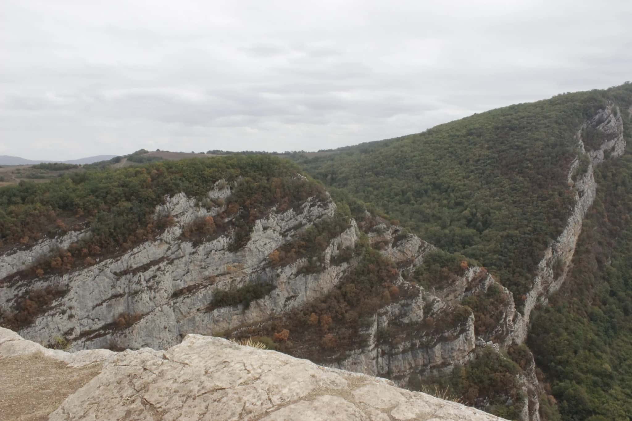
Lachin sits in high, green country where the mountains fold into river valleys. That position made it strategically important long before modern times: whoever held Lachin influenced movement across the western approaches to Karabakh. For a visitor, the appeal is the landscape, forested slopes, mountain air, and the sense of entering the region through a natural gate.
The country here belongs to the western, mountain side of Karabakh. It is a landscape of ridges, wooded slopes and cold rivers running down from the peaks rather than the flatter plains further east. If you picture Karabakh as a gradient from lowland fields up to alpine country, Lachin sits in the transition, high enough to feel like mountains, low enough to be the natural doorway to them. It neighbours the higher alpine district of Kalbajar and shares much of its character of clean air, long horizons and green summer slopes.
The role of the corridor
Lachin is closely tied to the road that links the region across the mountains. This route has been central to how Karabakh is reached and how its parts stay connected, and it remains part of any conversation about travel logistics in the west. The town's importance is inseparable from that road.
This is the thread that runs through Lachin's whole story. A settlement grows up where a route must pass, and the route matters because the terrain leaves few alternatives, mountains channel movement into the valleys, and the valleys converge here. That is why Lachin has long been described as a gateway: it is less a destination people set out for than a threshold people pass through, and the town draws much of its significance from that.
A crossroads history
Because it commands a natural passage, Lachin has long sat at the meeting point of routes and peoples. Highland districts like this one were historically pastoral country, communities that moved with the seasons between valley and high pasture, a rhythm the whole western mountain belt of Karabakh shares. The wider region has been shaped over centuries by the traditions of the Karabakh khanate and the layered cultures of the South Caucasus, and a mountain crossroads such as Lachin naturally felt all of that traffic: traders, herders and travelers moving between the lowlands and the peaks.
For a visitor, the history is best understood as landscape rather than a checklist of monuments. The story of Lachin is written in its position (in the road, the passes and the valleys) more than in any single building. That is part of what makes it a place to understand rather than a set of monuments to visit. For the bigger picture of why the region draws travelers today, see why Karabakh matters as a destination now.
The landscape and the seasons
Lachin's appeal is, above all, its scenery. Forested slopes, mountain air and river valleys make it a place valued for atmosphere as much as for any specific sight. Like the rest of the western mountains, it changes completely through the year. In the warm months the slopes are green, the rivers run full, and the air is at its most pleasant, the classic image of a Caucasus mountain summer. Autumn turns the wooded hillsides gold and russet; winter brings snow and short days to the high ground.
This rhythm is worth understanding when you plan, because the Lachin most travelers picture (green forest, running water, warm mountain air) is very much a warm-season landscape. The higher you go the cooler it stays even in summer, so this is high country to be read by the season rather than the calendar. For how the seasons play out across the whole region, see our guide to the best time to visit Karabakh.
What to bring and how to plan for the mountains
Lachin is changeable mountain country, so a little preparation goes a long way. In general terms:
- Layers. Mountain weather turns quickly and evenings are cool even after a warm day. Bring something warm and something waterproof whatever the season.
- Sturdy footwear. This is a landscape you take in on your feet, often on uneven ground, proper shoes matter more than they would in the city.
- Sun and water. At altitude the sun is stronger than it feels; carry water and sun protection.
- Time, not a checklist. The reward here is scenery, air and the feel of the place rather than a list of sights to tick off, so leave room simply to stop and look.
Lachin today
Like much of Karabakh, Lachin is part of the region's reconstruction and resettlement effort, with new housing and infrastructure taking shape. The new Lachin Airport anchors the western gateway, making the mountainous side of the region far more reachable than it once was, as covered in our guide to the new Karabakh airports.
How to fit it into a route
Lachin works as part of a western Karabakh loop, paired with the alpine country around Kalbajar. Because it sits at the doorway to the western mountains, it makes natural sense as the entry point to that side of the region before the high country opens up. Many travelers balance a landscape-led western leg like this against time in Shusha, the historic and cultural centre of Karabakh, for a trip that pairs scenery with heritage.
If you are building a broader route, our Karabakh tours page and the wider Karabakh region guide are the places to start. As always, plan around the official framework first. Start with the Karabakh access guide.
Which official signals support this
- the presidential program document treats regional resettlement and infrastructure as a priority
FAQ
Where is Lachin?
Lachin is a mountain town on the western side of Karabakh, set in high forested country where valleys and routes meet. It has long been a strategic crossroads.
Why is Lachin important?
Its position controls the western approaches to Karabakh, and it is tied to the mountain road that connects the region. That makes it central to how Karabakh is reached.
What is there to see?
The main draw is the mountain landscape and the sense of entering Karabakh through a natural gateway, best combined with a wider western route. Lachin is a scenery destination more than a monument one. Its story is written in the road, the passes and the valleys.
When is the best time to visit Lachin?
The warmer half of the year is generally most rewarding, roughly late spring through early autumn, when the slopes are green and the rivers are full. High ground stays cool even in summer, and winter brings snow at altitude. See our best time to visit Karabakh guide for the seasonal picture across the region.
How does Lachin fit into a Karabakh trip?
It suits a western, mountain-focused route as the gateway to that side of the region, pairing naturally with the alpine district of Kalbajar and balanced against the cultural centre of Shusha. Our Karabakh tours page is a good place to start shaping a route.
Can travelers visit Lachin?
Lachin is part of the region's reconstruction, and the new Lachin Airport improves access.
Want to explore the mountainous side of Karabakh? Message Pink Travel on WhatsApp with your dates. Explore our Karabakh tours or reach out via our contact page.
Plan Your Karabakh Trip
The main Karabakh planning pages in one place
The hub, tours page, Shusha page, and key guides are grouped together so readers can build context before making a travel decision.
For a long time, Karabakh was mostly known from a distance. Now Shusha, changing access rules, and rebuilding tourism infrastructure are turning it into a destination people can plan with more intention.
Shusha-led routes of one to three days, your entry permit filed for you, and a firm per-person price before you commit to anything.
Why the official Karabakh permit portal won't work for you